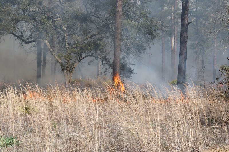
Prescribed burns are a matter of routine for Fort Stewart and the people charged with looking after its thousands of acres of woodlands.
And they’re so good at it, nearly 100 scientists from across the country came to the sprawling post to understand the effects of prescribed burns and how beneficial those are to the base’s diverse ecology.
“With our prescribed burning, we are achieving multiple goals simultaneously to support the military training mission,” said Bryan Whitmore, who runs the Directorate of Public Works’ Environmental Division’s Forestry unit prescribed burning.
Researchers and scientists watched as fires started from the air, thanks to a helicopter, and from the ground along the Liberty-Long county line in the base’s western reaches.
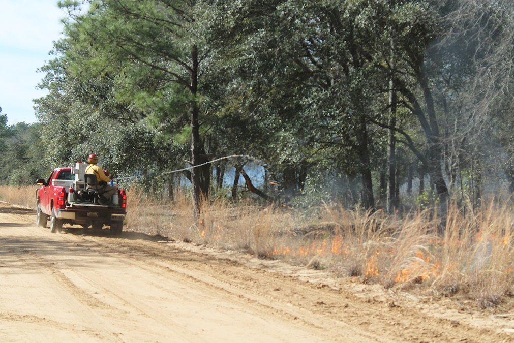
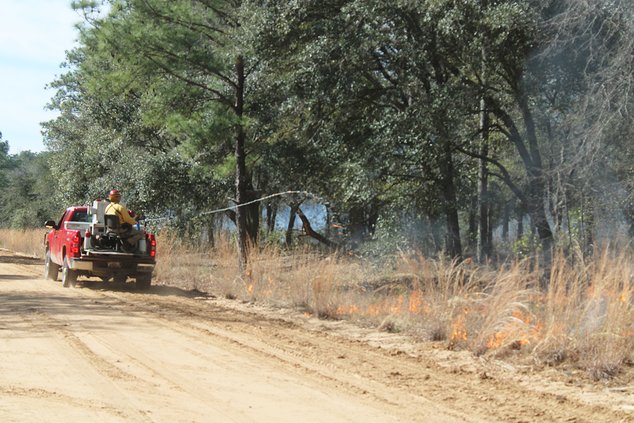
Helicopters dropping ping-pong-sized balls ignited blazes deeper into the woods. From the road, a terra torch sprayed the grass and underlying brush, which burst into flames rapidly.
A helicopter and a Fire Hawk airplane flew overhead, mapping the fire and the smoke pattern, and scientists on the ground pin pointed where the fire went and the trail it left behind.
Fort Stewart has the largest forestry program in the Army. As part of the 278,000 acres covering parts of five counties, there are nearly 140,000 acres of pine forest, along with 74,000 acres of forested wetlands, 58,300 acres of forest openings and 9,600 acres of hardwood forest.
“I would argue they are probably one of the top prescribed fire programs in the world. It’s outstanding,” said Joe O’Brien with the Forest Service’s Prescribed Fire Science Lab in Athens. It’s a pleasure to work here.”
Burn season across the installation is in full effect – but Fort Stewart Forestry staffers also make sure the conditions are just right before lighting a match.

“Typically, wind direction is a big one,” Whitmore said of the pre-burn factors, “because we want it to be pushed away from populated areas. It can become a problem if it is too dry.”
The post typically burns the 49,000 acres that serve the Army’s firing ranges each year. The remainder of the territory is burned on a three-year rotation.
Fort Stewart’s gunnery ranges haven’t lost a day of training to fire since 2000.
“So when the military is firing, tracer rounds and artillery can create a wildfire,” Whitmore said. “We prescribe a burn so the fuel is removed, so their impact areas aren’t catching fire.”
A system that is fire-dependent
A typical burn area covers 600 acres, and the base tries to have prescribed burns on about 115,000 acres annually.
The longleaf pine forest is the most prevalent at Fort Stewart and it once covered millions of acres across the Southeast. The ecosystem has adapted to the prescribed burn program, experts said. In fact, it now depends on prescribed burns for its continued health.
“Without fire, this system starts to fall apart,” O’Brien said. “This system has adapted to fire every two years. It creates the forest structure and species composition that we find valuable. A lot of rare and endangered species thrive here. It also builds in the biodiversity and safety in the landscape. You’re not only helping the forest environment but you’re keeping the fuel loads down.
“In a system like this, fire is as important as sunshine and rainfall. You take away fire, you lose the ecosystem.”
Not burning is considered a disturbance for the ecosystem, said U.S. Forest Service research ecologist Louise Loudermilk.
“There are hundreds of plant species that thrive in a burn area,” she said. “It sort of cleans the slate in the understory, so when it burns the grasses and shrubs, it creates an environment that opens it up for multiple species to live. If you come here later in the spring and the fall, you’ll see hundreds of flowering species that wouldn’t be there if it wasn’t burning so often.”
Wetlands serve as a natural barrier for the fires and on those occasions when the wetlands aren’t so wet, fire can be good for those, too.
“You get a lot of really, really interesting species such as pitcher plants,” Loudermilk said. “There is insect diversity. It’s a really unique ecosystem that would not be around if it were not burning all the time. If you take fire out of it, the pines aren’t able to regenerate, the underbrush starts to choke each other out. The fire reduces the competition. When you start taking the fire and the plants and animals start competing, they’ll die off. The species diversity will drop off without fire.”
Smoke gets in your eyes
While smoke rising from the trees on Fort Stewart is a routine sight this time of year for many residents, for newcomers, it can be alarming. Forestry officials also try to limit the smoke’s impact on neighboring civilian communities.
“We get complaints about the smoke and we try to mitigate that,” Whitmore said. “It’s a constant outreach to get them to understand the ecosystem they’re moving into. They need to understand the smoke and fire here is a crucial element to the military training mission and maintaining the threatened and endangered species here.”
As dozens of scientists clad in yellow Nomex tops and green Nomex trousers observed and took part in February 8’s burn, they also took note of the smoke emitted and its pattern.
“A perfect day would be a day like today with a touch more wind,” O’Brien said. “You want to have enough wind to dry the fuels out but also disperse the smoke so it doesn’t impact the community. These guys are consummate professionals at handling their smoke. You don’t want it to be too low intensity because it won’t burn.”
Several miles away, tanks from the 1st Armored Brigade Combat Team fired their main gun rounds on ranges off Highway 119. As helicopters and a Fire Hawk plane circled thousands of feet above to measure the fire and the smoke, researchers also plotted its direction and which underbrush burned and how fast it went up in flames.
The Integrated Research Management Team looked at the fire behavior – how much a fire burns – the fuels and those burn and affect the fire, micro meteorology and smoke.
“It’s safer here and easier to manage the logistics of a burn and taking measurements of a burn,” said Andy Hudak of the U.S. Forest Service’s Rocky Mountain Research Station in Moscow, Idaho. The finer fuel, the grasses, that’s more dynamic, and there is different proportions of that but the same principles still apply. We can test those ideas here. Those measurements inform the models and those models apply elsewhere too.”
The installation’s burn season runs from December 1-June 30 and to the beginning of March, it’s known as “the golden season.”
Burn season is followed by the growing season, when Forestry burns a lot of endangered species habitat to get the regeneration of those lower fuels those species require, Whitmore said.
“One of the world’s top prescribed fire programs is out there managing the forest the right way and creating a much safer environment for the military on the base while simultaneously maintaining the habitat,” O’Brien said.

